Unlocking climate change facts from within one of France’s most remote and inaccessible glaciers.
The Arcouzan Glacier is the most difficult and dangerous glacier to access in the Pyrenees. Its first recorded visit was from Jean Pierre Pages in 1808 who left his readers in little doubt that access was arduous, “To reach the glacier, one must have abdicated all fear of death”.
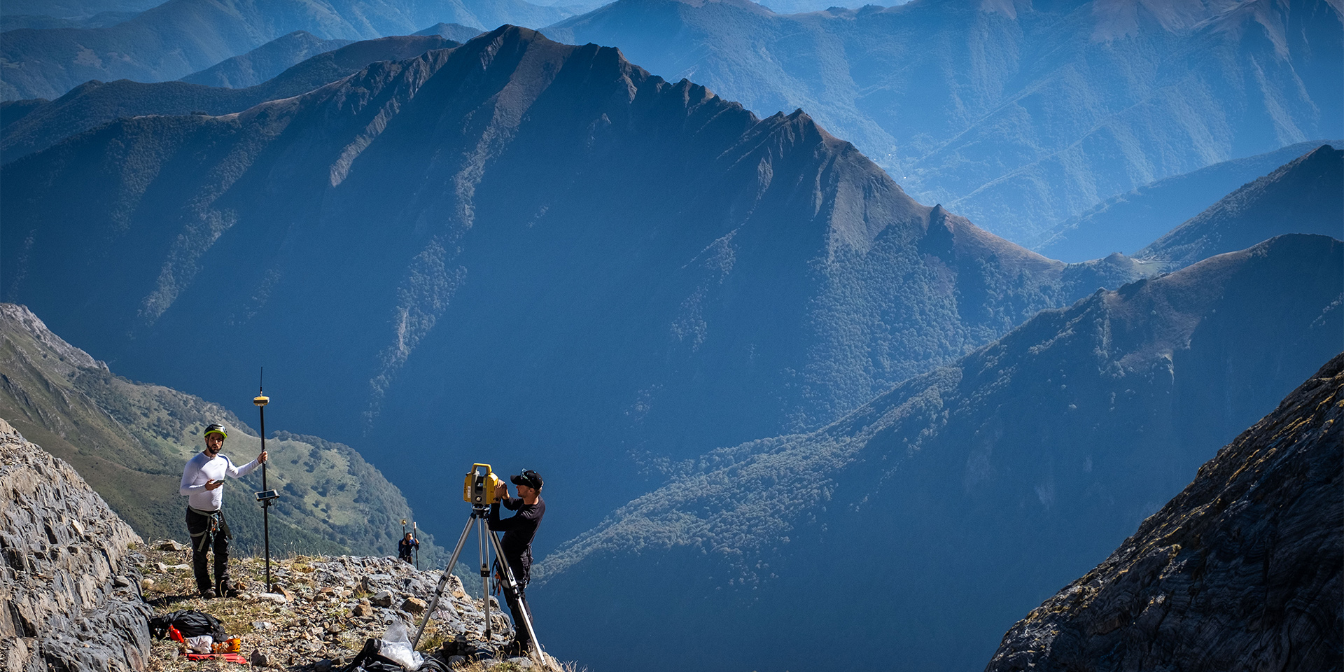
It was not tales of bravery that attracted a multi-disciplinary team of geometric surveyors, scientists and national park guides to the glacier from 28th to 30th September 2023. Rather, this funnel shaped block of ice has an important role to play in understanding the effects of climate change, specifically on glaciers and more widely on our planet.
As well as being the remotest in the Pyrenees, The Arcouzan Glacier is critically one of the smallest and most resilient. At between 2,320 and 2,520 metres it is relatively low. Yet its north-easterly aspect protects it from the sun during the summer months, and snowfall from Mont Valier replenishes it through winter.
Between 2005 and 2018 evidence suggested the surface area of the Arcouzan Glacier had actually increased.
Previous measurement of the glacier had positioned it as an outlier to the global pattern of melting and reducing ice. It was therefore critical that the team from TERIA and Topcon, along with scientists, academics and representatives from the national park learned all they could about why and how this glacier seemed to be behaving in an exceptional way.
The correct starting point for all geodetic expeditions is the centimetric accuracy offered by Topcon’s Global Navigation Satellite Systems (GNSS). The accuracy of all Topcon equipment is a given. Just as important for this task was its robustness and ease of use in challenging environments which made this equipment perfect for the task.
Creating change through collaboration
The expedition was jointly funded by TERIA and Topcon. Geometric surveyors, together with guides and specialists from the Ariège national park were involved, along with academics, researchers and student observers. Together learning about the accuracy and craft of surveying with cutting edge technology. Knowing that a deeper understanding of climate change needs to be built on facts.
The findings were clear and stark. And flipped the previously surprising results regarding the glacier’s growth. Accurate measurement was able to prove without doubt that the glacier was reducing dramatically in both surface area and thickness despite previous misconceptions.
Since 2016, variations in volume and surface area have been decreasing. Winters with little precipitation and exceptionally warm summers being the main contributors. This latest measurement expedition using 3D scanners and GNSS has shown that its decrease continues. Indeed, between 2021 and 2023, the glacier shrank by a thickness of 3.9 metres of water blade.
Growing our knowledge of glaciers is critical. In contrast to most other geological processes glacier change is rapid. The Arcouzan Glacier’s sensitive and dynamic response to recent changes in both temperature and snowfall combined with its previous resilience makes it an excellent indicator of climate change.
Rock, ice and the last of France’s brown bears.
The Ariège Pyrenees are not only the perfect place to gather information, but they are also the ideal setting to reflect on the importance of protecting our wild places. This is France at its most remote and unspoiled. Amongst the limestone and schist rock of the Ariège Pyrenees this shrinking block of ice provides a clear focus point. Amongst an array of wildlife, it is home to chamois, marmots and the last remaining population of Pyrenean brown bears in France.
Reflecting on his three days on the glacier Topcon’s Jasper Vos wrote, “These remote and truly quiet mountains of the Pyrenees are one of the last wildernesses of Europe. They have so much to teach us if we are prepared to listen. Spending time there and seeing the effects we are having on the planet is a moving experience. I just hope that our research can have an effect and help to cut-through any apathy that still exists around climate change.”
The recent thinning and retreat of the Arcouzan glacier over recent years may be silent but its message could not be clearer. The rate of climate change is quickening, and effects are being recorded and felt everywhere.
Michael Gomes, Vice President, Global Sustainability for Topcon commented “We are very enthusiastic about this innovative example of how a Topcon’s technology is being used to help measure and characterize implications of Climate Change. It is a great example of how data and “documentation of practice” can create a valuable data layer that help quantify the situation related to SDG #15 – Life on Land and potentially impacts of Climate Change. We appreciate both the transparency and the sophistication, that these measurements represent to the scientific community and our global citizens.”
Results from the joint TERIA and Topcon geodetic expedition are quietly and insistently calling to us. To work together. To learn more. And to act decisively. Now, more than ever, it is time for work that matters.
Listening to the secrets locked in ice.
Arcouzan Glacier Facts:
• Location 09140 Seix
• Mont Valier massif 2838 m
• Salat watershed
• North-East exposure
• Area 1.8 ha (5 ha in 1850)
• Altitude between 2320 and 2520 m
• length 370 m and width 90 m
• Rock: Limestone / Schist
• Type: funnel-shaped over-accumulation glacier
• Geographic coordinates: 42°47'55" lat. N / 1°05'20" long.